CHULU WEST EXPEDITION
Home / CHULU WEST EXPEDITION
moderate

CHULU WEST EXPEDITION

duration icon
Duration
17 Days
altitude icon
Max Altitude
6,419m
group icon
Group Size
Max 2 - 4
coordinates icon
Coordinates
28°44′36″ N, 84°01′21″ E

Trip Summary

Chulu West stands in the Manang District of north-central Nepal, within the Annapurna Conservation Area — the largest protected area in Nepal at 7,629 square kilometres. The conservation area is a natural habitat of extraordinary biodiversity: rhododendron and pine forests at lower elevations give way to alpine meadows and glaciated high terrain, while wildlife including Himalayan blue sheep (bharal), snow leopards, red pandas, and Himalayan tahr inhabit the surrounding landscape. The journey to Chulu West is not just a climb — it is an immersion in one of the most ecologically and culturally significant regions in the country.


The Chulu massif sits above the small valley of the Ghyanchang Khola, tucked north of the main Annapurna Circuit trekking route. From the Manang valley, Chulu West appears as a broad, snow-covered peak with a distinctive profile. The standard approach branches away from the main circuit route at Ledar village and climbs into the side valley leading to Base Camp at 4,900m. The terrain becomes progressively more remote and glaciated as the Base Camp is approached — a genuine transition from trekking to expedition territory.


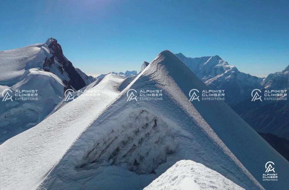
The summit route follows the Northwest Ridge from High Camp at approximately 5,100m. The ascent involves sustained movement on snow and some icy sections that require crampons and ice axe use throughout. The summit day is long and physically demanding — nine to ten hours of continuous effort at altitude — but the route does not involve the sustained vertical technical climbing of peaks like Ama Dablam or Cholatse. What Chulu West demands more than technical skill is stamina, mental commitment, and respect for the conditions at 6,400 metres.


One of the defining features of the Chulu West expedition is what comes after the summit. Rather than retracing the approach route, the itinerary continues across the Thorong La Pass (5,416m) — one of the highest and most famous mountain passes in the world and descends to the sacred town of Muktinath before continuing through the Mustang region to Tatopani and Pokhara. This circular route gives the Chulu West expedition a narrative arc that very few 6,000-metre climbs in Nepal can match.

Trip Overview

Duration
17 Days
Including travel days
Max Altitude
6,419m
Summit of CHULU WEST EXPEDITION
Best Season
Spring & Autumn
Ideal climbing window
Group Size
Max 2 - 4
Small team support
Region
Annapurna Region
Expedition location
Grade
Moderate
High-altitude guided climb
Trip overview background

Trip Description

Chulu West (6,419m) is one of the most rewarding climbing objectives in Nepal's Annapurna region — a peak that offers something genuinely different from the Khumbu valley experience. Sitting north of Manang above the Ghyanchang Khola valley, Chulu West is part of the Chulu massif, which also includes Chulu East (6,584m) and Chulu Far East. Of the three, Chulu West is the most popular climbing objective as it is technically more approachable than Chulu East, while still demanding the stamina, fitness, and mountaineering technique that make a 6,000-metre summit feel genuinely earned.


The mountain was first summited in 1952 by a Japanese climbing team — one of the earlier first ascents among Nepal's permitted trekking peaks. Since then, it has become well-regarded among climbers who want a serious high-altitude objective in a less-crowded setting than the Khumbu. The route follows the Northwest Ridge from Base Camp at 4,900m, climbing through mixed snow and ice terrain to the summit. The approach itself is a highlight — the itinerary follows the classic Annapurna Circuit trekking route from Besisahar through Chame, Pisang, and Manang, offering one of the finest cultural and landscape journeys in all of Nepal before the climbing begins.


Chulu West is physically demanding rather than highly technical. The long summit day — beginning before dawn and involving nine to ten hours of movement at high altitude is the primary challenge. Sections of steep snow and ice on the upper mountain require crampons, ice axe, and basic rope technique, and the altitude demands a properly managed acclimatization schedule. This is a climb for people who are fit, motivated, and willing to prepare seriously — and the summit reward is extraordinary.


From the top of Chulu West, the panorama spans one of the widest and most dramatic mountain horizons in the Himalayas: Dhaulagiri, Annapurna I, II, III, and IV, Nilgiri, Tilicho, Gangapurna, Manaslu, Himlung, Pisang Peak, and Thorong Peak fill the southern and eastern horizons, while the vast, open landscape of the Tibetan Plateau extends to the north. Very few 6,000-metre summits in Nepal deliver a panorama of this scale.


At Alpinist Climber Expeditions, every Chulu West expedition is organized and guided by IFMGA-certified professionals who combine the highest technical standards with deep knowledge of the Annapurna region. The itinerary continues past the summit through the Thorong La Pass (5,416m) and onward to Muktinath and Pokhara before returning to Kathmandu, giving the expedition a complete, circular character that most Annapurna region climbers find deeply satisfying.


Expedition Highlights

  • A compelling 6,000m objective in the Annapurna region — away from the crowds of the Khumbu

  • Follows the classic Annapurna Circuit route through Chame, Pisang, and Manang — a journey of exceptional cultural and scenic richness

  • Summit panorama of unrivalled breadth — Dhaulagiri, Annapurna massif, Manaslu, Nilgiri, and Tibetan Plateau visible simultaneously

  • Crossing the legendary Thorong La Pass (5,416m) on the descent — one of the world's most famous high mountain passes

  • Sacred Muktinath Temple en route — one of the most revered pilgrimage sites in both Hinduism and Buddhism

  • Route passes through Gurung and Thakali villages with authentic cultural character close to the Tibetan border

  • Wildlife of the Annapurna Conservation Area — blue sheep, Himalayan tahr, red pandas, and the elusive snow leopard

  • Option for 1:1 private summit experience alongside IFMGA Guide Mr. Prakash Sherpa

Detailed Itinerary

A representative from Alpinist Climber Expeditions meets you at Tribhuvan International Airport and transfers you to your hotel in Kathmandu. After check-in, you meet your expedition guide and fellow team members for the first time. The evening opens with a welcome dinner — a relaxed and informal introduction to the team and the journey that begins the following morning.

The morning begins with a full expedition briefing — route overview, safety protocols, equipment checks, permit formalities, and Ministry of Tourism requirements. At the team meeting, you receive your Alpinist Climber Expeditions duffel bag and cap, and confirm packing for the days ahead. The afternoon is spent visiting UNESCO World Heritage Sites in the Kathmandu Valley — ancient temples, Buddhist stupas, and historic Newari architecture that provide a meaningful cultural introduction before the Annapurna journey begins.


  Duration     Distance     Elevation  
Full Day 5–10 km (city tour) Minimal

Departing Kathmandu early by private jeep, the drive takes approximately four to five hours along winding roads through the Nepalese countryside — terraced farmland, river valleys, and rural villages marking the transition from the capital to the mountain world ahead. Besisahar is the traditional starting point for the Annapurna Circuit and the gateway to the Marsyangdi Valley. Overnight in Besisahar to prepare for the long drive into the mountains the following morning.


  Duration     Distance     Elevation  
6–7 hrs ~175 km −570 m (1,330 m → 760 m)

An early start for the drive along the Marsyangdi River valley into the Annapurna region. The road climbs through forested ridges with several dramatic valley sections, offering the first clear views of Lamjung Himal, Annapurna II, and Annapurna IV rising above the treeline. The landscape shifts rapidly from subtropical forest to the drier, more exposed terrain of the upper Marsyangdi as the vehicle climbs to Chame — the administrative centre of Manang District and the starting point for tomorrow's trek.


  Duration     Distance     Elevation  
6–8 hrs ~65 km +1,890 m (760 m → 2,650 m)

The trek from Chame follows the Marsyangdi River through dense pine and rhododendron forest before emerging at a dramatic curved rock face rising 1,500 metres directly above the river — one of the most striking geological features on the entire Annapurna Circuit. As the valley opens into the broad, flat U-shape of the upper Marsyangdi, the enormous scale of the surrounding massif becomes fully apparent for the first time. Pisang sits at the valley's edge with wide views of Pisang Peak and the high ridges ahead.


  Duration     Distance     Elevation  
5–6 hrs ~14 km +600 m (2,650 m → 3,250 m)

The trail from Pisang follows the upper valley toward Manang, passing through the celebrated Barge Monastery — the largest in the Manang district and worth a brief stop for its setting and cultural significance. The panoramic views on this section are exceptional: Annapurna II, Annapurna III, Gangapurna, and Tilicho Peak frame the horizon as the trail approaches Manang. The town itself is a well-supplied, characterful hub for climbers and trekkers heading into the high Annapurna terrain.


  Duration     Distance     Elevation  
5–6 hrs ~16 km +269 m (3,250 m → 3,519 m)

A structured acclimatization day in Manang before the significant altitude gain of the days ahead. A hike to higher ground — toward the ridge above town or the slopes of the surrounding valley — follows the key principle of climbing high and sleeping low. The Himalayan Rescue Association often provides altitude briefings in Manang during the trekking seasons — a useful and practical session that the guide will recommend where available. Rest, hydration, and a good meal in the evening are equally important preparations for what comes next.


  Duration     Distance     Elevation  
3–5 hrs (optional hike) 5–8 km +400–600 m (optional hike, return to Manang)

Leaving Manang, the main Annapurna Circuit trail climbs steadily through high-altitude vegetation — the rhododendron and juniper forest of the lower valley giving way to open alpine terrain dotted with yak grazing grounds. The trail passes through Yak Kharka before reaching Ledar — a small settlement commonly used as a rest stop for teams heading either to the Thorong La or to Chulu West Base Camp. From Ledar, the Chulu West trail branches away from the main circuit and into the side valley to the north.


  Duration     Distance     Elevation  
4–5 hrs ~10 km +854 m (3,519 m → 4,373 m)

From Ledar, the trail leaves the Annapurna Circuit behind and climbs into the quieter, more remote valley of the Ghyanchang Khola. The terrain becomes increasingly glaciated and rugged as the path gains altitude toward Base Camp at 4,900m — a sheltered location on flat moraine ground with Chulu West's Northwest Ridge visible directly above. Tents are pitched, equipment is organised, and the expedition's climbing phase formally begins. The views of the Annapurna massif from Base Camp on a clear afternoon are already extraordinary.


  Duration     Distance     Elevation  
4–5 hrs ~7 km +527 m (4,373 m → 4,900 m)

After an early breakfast, the team moves upward from Base Camp toward High Camp at approximately 5,100m. The route gains altitude steadily through snow and rocky terrain on the lower Northwest Ridge. High Camp is positioned to provide the shortest and most efficient line to the summit for the following day's push. Tents are pitched, equipment is checked and rechecked, a hot meal and plenty of fluids are taken, and the team rests as early as possible in preparation for the pre-dawn summit start.


  Duration     Distance     Elevation  
3–4 hrs ~3 km +200 m (4,900 m → 5,100 m)

Summit day begins at approximately 3:00am. The team dresses carefully in the darkness, takes a light breakfast, confirms equipment, and begins moving upward by headlamp. The route from High Camp ascends the Northwest Ridge through sustained snow and intermittent icy sections — crampons and ice axe are in use from the outset. The upper mountain opens onto a broad snow plateau that leads toward the summit dome, with the angle steepening on the final approach. Nine to ten hours of continuous effort separate the 3:00am departure from the summit of Chulu West at 6,419 metres.


From the top, the panorama is staggering. Dhaulagiri (8,167m), Annapurna I (8,091m), Annapurna II, III, and IV, Nilgiri, Tilicho, Gangapurna, Manaslu, Himlung, and Pisang Peak fill the southern and eastern horizons, while the vast, brown expanse of the Tibetan Plateau stretches away to the north — a view that takes in two entirely different worlds at once. After time on the summit, the team descends carefully to Base Camp for the night.


  Duration     Distance     Elevation  
10–14 hrs ~10 km +1,319 m (5,100 m → 6,419 m, then descend to Base Camp)

A reserve day built into every Chulu West expedition. High-altitude weather in the Annapurna region can change quickly, and this buffer provides the team with flexibility to attempt the summit on this day if conditions were not suitable on Day 11. If the summit has already been reached, this becomes a rest and recovery day at Base Camp before the descent toward Thorong Phedi begins.


  Duration     Distance     Elevation  
Full Day Varies Varies

Breaking Base Camp and descending back to Ledar, the team rejoins the Annapurna Circuit trail and continues eastward toward Thorong Phedi — the last lodge settlement before the Thorong La Pass and the staging point for tomorrow's high-pass crossing. The drop in altitude from Base Camp is immediately welcome and the team rests well in preparation for the long pass day ahead.


  Duration     Distance     Elevation  
5–6 hrs ~10 km −360 m (4,900 m → 4,540 m)

An early start before dawn for the crossing of Thorong La Pass (5,416m) — one of the highest and most celebrated mountain passes in the world and one of the defining moments of the Annapurna Circuit experience. The ascent from Thorong Phedi to the pass takes three to four hours in typical conditions. From the pass, the Annapurna and Dhaulagiri massifs spread across the horizon in every direction — a fitting final high-altitude panorama after the summit of Chulu West.


The descent to Muktinath is long and steep but well-tracked. Muktinath at 3,710m is one of the most sacred pilgrimage sites in the Himalaya — revered equally by Hindus and Buddhists, its temple complex and natural gas flames have drawn pilgrims for centuries. The team arrives in time to visit the temple and rest before the drive the following morning.


  Duration     Distance     Elevation  
8–10 hrs ~16 km +876 m / −1,706 m (ascend to Thorong La, then descend to 3,710m)

A morning drive from Muktinath descends through the dramatic landscape of the Mustang region, passing through the apple-farming village of Marpha — well known for its brandy and orchards — and the regional hub of Jomsom before continuing south through the Kali Gandaki Gorge, one of the deepest gorges in the world. Tatopani, at 1,190m, is named for its natural hot springs — a deeply welcome stop after the exertion of the past several days. The evening is free to soak, rest, and recover.


  Duration     Distance     Elevation  
5–6 hrs ~75 km −2,520 m (3,710 m → 1,190 m)

Departing Tatopani, the road winds through the lower Annapurna foothills toward Pokhara — Nepal's second city and one of the most beautiful lake settings in the Himalayan world. The drive takes several hours along roads that improve progressively as the mountains recede. Pokhara sits on the shore of Phewa Lake with Machapuchare (Fishtail) and the Annapurna range rising dramatically behind it. The afternoon is free to explore Lakeside, take a boat on the lake, or simply rest before the flight back to Kathmandu.


  Duration     Distance     Elevation  
4–5 hrs ~105 km −368 m (1,190 m → 822 m)

An early flight returns the team to Kathmandu. The afternoon is free for rest, shopping for souvenirs in Thamel, or a final walk through the city. In the evening, a farewell dinner marks the successful conclusion of the expedition — a celebration of the summit, the Thorong La, and a journey through one of the most culturally and geographically extraordinary regions in the world. A private transfer to the airport is arranged for your outbound flight.


  Duration     Distance     Elevation  
25 min flight ~145 km (air) +508 m (822 m → 1,330 m)

Why ACE?

Alpinist Climber Expeditions was built around a principle that has guided every climb we have organized — that the quality of the experience on a mountain is directly tied to the quality and depth of experience of the people leading it. What sets Alpinist Climber Expeditions apart is something that cannot be manufactured or replicated — it comes from decades spent on these mountains, from the culture that formed us, and from a deeply held belief that every climb deserves to be done properly.


We are a team of professional Sherpas. Not guides who have visited the Himalaya — guides who grew up here, who know these peaks in every season, and who have spent careers developing the technical skills and mountain judgment required to lead expeditions safely and successfully.


Our team holds IFMGA / UIAGM certification — the highest international standard in professional mountain guiding — alongside Advanced Mountaineering, Wilderness First Aid, Helicopter Rescue, and High-Altitude Rescue qualifications. Our lead guide has summited multiple 8,000-metre peaks, including ascents without supplemental oxygen. This is not a credential on paper. It is a lived capability that directly protects every climber who climbs with us.


We offer two expedition structures: a standard option with small-group expedition, and a premium option with 1:1 guide-to-client ratio. Both are built on the same standard of safety, preparation, and professionalism.The standard option maintains a minimum 1:3 guide-to-client ratio with a dedicated IFMGA lead guide and Sherpa support on every climb. Our premium 1:1 private option places you on the mountain directly alongside IFMGA Guide Mr. Prakash Sherpa.


We do not run high-volume operations as our clients are not bookings. They are climbers who have chosen to trust us with something significant and we take that trust seriously on every single expedition. We do not cut corners on acclimatization, staffing ratios, or safety equipment. We organize expeditions the way they should be organized — with patience, precision, and the kind of local knowledge that only comes from growing up in these mountains and spending a career on them.


The Team

Expedition Guides

Every guide on our team has been selected for their technical ability, high-altitude experience, and personal commitment to the safety and success of every climber they lead. All guides carry extensive experience at altitude and hold a proven record of safety, summit success, and strong compatibility with international clients.

The number of guides assigned to each expedition is determined by the size of the climbing team. Our standard guide-to-member ratio is 1:3, ensuring that every climber receives consistent, attentive support throughout the approach, the acclimatization phase, and the technical climb itself.


Climbing Sherpa Support

A dedicated team of experienced Climbing Sherpas supports every expedition with load carrying on the mountain, route preparation, and high camp management. On summit day, we maintain a 1:1 Sherpa-to-climber ratio — a commitment that reflects our belief that the summit push is where support matters most.

Our Climbing Sherpas are not simply load carriers. They are experienced high-altitude professionals who understand the mountain, the route, and the demands of summit day. Their presence alongside every climber on the final push is a core part of how we manage safety and success on the upper mountain.


What to Expect from Our Team

  • Technically qualified, IFMGA-certified lead guidance on every expedition
  • A standard guide-to-member ratio of 1:3 — adjusted based on team size and peak requirements
  • 1:1 Climbing Sherpa support on summit day for every team member
  • Guides who are experienced, companionable, and genuinely invested in your success
  • Full medical kit, satellite communication, and emergency response capability carried by the team at all times
  • A premium 1:1 private option available — summit alongside Mr. Prakash Sherpa directly


Trip Notes

Quick facts: 6,419m | Manang region, Annapurna Circuit | Best season: spring (Mar–May) & autumn (Sep–Nov) | Graded PD/AD– – moderate, less technical


Overview


Often described as the “Mera Peak of the Annapurnas,” Chulu West combines the classic Annapurna Circuit trek with a high-altitude summit, making it a rewarding option for climbers who want big mountain views without highly technical climbing. The route passes through Gurung villages, alpine forests, and the dramatic Marsyangdi Valley before reaching the Tibetan-influenced upper Manang region.


Route & Character


After acclimatising along the Annapurna Circuit trail, the route leaves the main path near Ledar to reach Chulu West Base Camp (around 4,800m) and a high camp near 5,600m. From there, the climb is largely a long, steady snow slog rather than a technical test, though loose rock sections between base camp and high camp may require fixed ropes for safety. The summit rewards climbers with views across Annapurna, Dhaulagiri, Gangapurna, and Manaslu.


Key Risks & Why They Matter


Long, exhausting summit push: While not steep or technical in the way Ama Dablam or Cholatse are, the sheer distance and altitude gain on summit day mean simple physical exhaustion is the main hazard — climbers who underestimate this “easier” peak sometimes find themselves more drained than expected.

Extreme cold and wind at high camp: High camp sits exposed at roughly 5,600m with little natural shelter, and the route is known for attracting cloud and wind even when nearby areas are clear — this is why guides watch weather closely before committing to a summit attempt from here.

Loose rock sections: The ground between base camp and high camp includes sections of loose, unstable rock that can shift underfoot or be dislodged by climbers above; fixed ropes are used on these sections specifically to reduce the chance of a slip or falling debris.

Altitude sickness: Although the Annapurna Circuit trek itself provides good acclimatisation, the final push above 6,000m still carries standard altitude risks, particularly for climbers who rush the days leading into base camp.


Note: All ACE expeditions are subject to the unpredictable conditions of the Himalaya. Weather at altitude can change within hours, and your safety always takes priority over the fixed schedule — if trails become unsafe, snow conditions deteriorate, or flights to remote airstrips are delayed by poor visibility or wind, we will adjust the itinerary, reroute, or arrange alternative transport as needed. These changes are made solely to protect you, and our guides will ensure the spirit and quality of your expedition is never compromised. ACE is not liable for costs arising from missed international flights due to such delays, so we strongly recommend comprehensive travel insurance covering trip interruption, flight disruption, and emergency evacuation before you travel.

Equipment List

The list below covers the personal gear essentials for the Chulu West Expedition. The long summit day and sustained high-altitude terrain demand well-fitted, well-tested equipment across every category. All personal items should be sourced and tested well before departure — particularly boots, crampons, and sleeping bag.


Headwear

  • Sun hat or lightweight cap

  • Warm fleece or wool hat

  • UV-protective sunglasses (category 4 recommended)

  • Buff or thin balaclava / face mask


Handwear

  • Lightweight fleece or wool inner gloves

  • Gore-Tex outer mitten gloves


Clothing

  • Gore-Tex waterproof jacket

  • Gore-Tex waterproof trousers

  • Hiking trousers

  • Fleece jacket or warm mid-layer — slim enough to layer under Gore-Tex shell

  • Moisture-wicking base layer top

  • Thermal base layer trousers

  • Down jacket with hood


Footwear

  • Well broken-in trekking boots

  • Double-insulated alpine climbing boots

  • Crampons compatible with alpine boots

  • Snow gaiters

  • Trekking socks (4–5 pairs)

  • Camp sandals or light slippers


Technical Climbing Equipment

  • Ice axe

  • Sit harness

  • Locking carabiners and belay device

  • Ascender (jumar)

  • Climbing helmet


Camping & Trekking Essentials

  • Sleeping bag rated to at least -20°C

  • 45-litre rucksack with rain cover

  • Large duffel bag with padlock (for porter loads)

  • Headlamp with spare batteries

  • 1-litre water bottles (x2)

  • Thermos flask

  • Trekking poles

  • Personal first aid kit


Hygiene & Sun Protection

  • Waterproof wash bag

  • Medium towel

  • Toiletries — soap, toothbrush, toothpaste

  • Sunscreen SPF 50+ including lip balm with sun protection

  • Hand sanitizer and handwash

  • Toilet paper and wet wipes

Includes background

Includes & Excludes

Included
  • Chulu West Peak climbing royalty fees
  • Summit route fixing fees
  • Annapurna Conservation Area Permit (ACAP)
  • TIMS (Trekkers' Information Management System) card
  • Garbage disposal and environmental management fees
  • All government taxes, VAT, and official tourism service charges
  • IFMGA-certified lead mountain guide — full wages and comprehensive insurance
  • Experienced Climbing Sherpa support — wages, summit bonus, full insurance, and equipment
  • Porters to carry trekking and expedition gear at a 1:1 member-to-porter ratio
  • All staff accommodation, wages, equipment, insurance, and medical provisions
  • 4-star hotel accommodation in Kathmandu with daily breakfast, welcome dinner, and farewell dinner (2 nights)
  • Hotel accommodation in Pokhara with breakfast (1 night)
  • Full-board lodge accommodation throughout the trekking approach and descent
  • High-altitude camp food for all members and guides during the climbing phase
  • Private jeep both ways — Kathmandu to Besisahar and return from Pokhara
  • Private vehicle airport pick-up and drop-off in Kathmandu
  • Domestic flight: Pokhara to Kathmandu on Day 17
  • Single private dome tent at Base Camp
  • High Camp tents shared between members and guides
  • Medical kit carried throughout the expedition
  • Satellite phone for emergency communication
  • Alpinist Climber Expeditions branded duffel bag, cap, and T-shirt per member
Not Included
  • International airfare (to and from Kathmandu)
  • Nepal entry visa fees
  • Lunches and dinners in Kathmandu outside of the included welcome and farewell dinners
  • Alcoholic and soft beverages
  • Internet and WiFi access
  • Personal clothing and climbing equipment
  • Personal first aid kit
  • Drone permit fees (if applicable)
  • Personal travel, medical, and emergency rescue insurance
  • Gratuities for guides, Climbing Sherpa, Base Camp staff, and porters

1:1 Experience with Your Lead Guide

Lead Guide

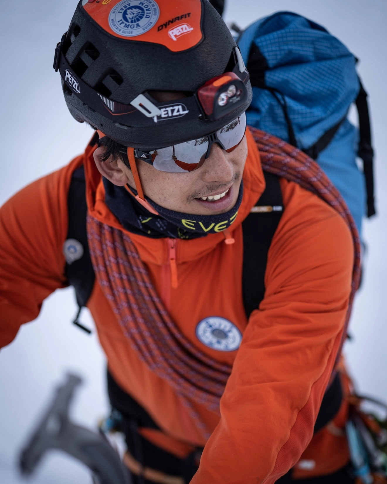
Prakash Sherpa

Founder & IFMGA Mountain Guide

Our lead guide Prakash Sherpa oversees expedition strategy, pacing, and on-mountain decision-making so your climb is supported from preparation through summit push.

You get direct access to experienced guidance, real-time judgement in changing conditions, and a more focused expedition experience built around safety, clarity, and strong leadership.

Certification
IFMGA / IVBV / UIAGM

Package Options

Standard

An expertly guided group expedition offering an affordable, memorable way to attempt stunning peaks alongside fellow adventurers.

Starting From
€3,600
per person
  • → Group Expedition
  • → 1:1 Climbing Sherpa Guide
  • → Well-Planned Itinerary
  • → Fixed Group Schedule
  • → Minimum 3 Participants
  • → Professionally Guided
  • → Excellent Value
  • → Best for Budget-conscious Adventurers
Book Standard
Premium

A fully personalized, private expedition with 1:1 IFMGA guiding — designed around your goals, pace, and schedule for an exclusive mountain experience.

Starting From
€5,600
per person
  • → Private Expedition
  • → 1:1 Private IFMGA Mountain Guide
  • → Fully Tailored Itinerary
  • → Flexible Scheduling
  • → Premium Value
  • → Private Jeep and Private camp
  • → Premium, Personalized Experience
  • → Best for Adventurers Seeking a Personalized, Exclusive Experience
Book Premium

FAQs

Chulu West (6,419m) is a peak in the Annapurna region of north-central Nepal, located north of Manang in the Manang District within the Annapurna Conservation Area. It is part of the Chulu massif, which also includes Chulu East (6,584m) and Chulu Far East. Of the three peaks, Chulu West is the most popular climbing objective — it is the most accessible in terms of technical difficulty, though it is by no means an easy ascent. The mountain was first summited in 1952 by a Japanese team and offers one of the widest summit panoramas available on any 6,000-metre peak in Nepal.

Alpinist Climber Expeditions
GUIDING BEYOND THE SUMMIT
Client Stories

From the Summit

Daniel Puttkemery
Daniel Puttkemery
Kyajo Ri Expedition
Prakash and his team are a couple of notches above totally professional! Everyone in the Alpinist Climber Expeditions family goes out of their way to provide the best possible experience. Superb core values and safety principles. I had the good fortune of climbing Kyajo Ri with Alpinist Climber Expeditions and…
Luca Smargiasso
Luca Smargiasso
Ama Dablam 6,812m
I have been climbing for 15 years, over 4 continents. This was my 3rd trip to Nepal. And this was undoubtedly one of the Best-organised expeditions have participated in. Cannot thank Prakash and his Team enough. The attention to detail both in terms of equipment, climbing conditions, and accommodation/food was…
Raphael Lindenmann
Raphael Lindenmann
Kyajo Ri
In April 2025, we completed an unforgettable expedition to Kyajo Ri with ACE. We were four friends from Switzerland and enjoyed about two and a half weeks in the Khumbu region. From our arrival in Kathmandu to the summit and back, ACE's organization was impeccable.A well-coordinated team, superb support, excellent…
Andy Tronsberg
Andy Tronsberg
Kyajo Ri & Island Peak
Perfect organised and guided expedition I ever took part! We climbed island peak and kyajo ri alpine style! Safety is always first, all team members are super kind and professional and also laughing comes not to short! Thanks for this unforgettable experience!! Andreas.
Rogier Keulen
Rogier Keulen
Mt. Kyajo Ri & Mt. Cholatse
With IFMGA guide Prakash we climbed Kyajo Ri and Cholatse. Our expedition couldn't have been any better! We had a lot of fun and summiting stunning Cholatse is the most intense thing I've done. We did it alpine style, so without fixed ropes from bottom to top. Safety was a…
Manu Laireiter
Manu Laireiter
Kyajo Ri
I participated in a private expedition to Kiayo Ri with Alpinist Climber Expeditions – and it was simply fantastic. From the initial consultation to the final summit push, everything was perfectly organized and tailored to my individual needs.The guides were not only highly professional and extremely experienced in high-altitude mountaineering,…
Expedition Journal

Dispatches from the Mountains

All Articles
Kyajo Ri Expedition Report 2022
Expedition Report

Kyajo Ri Expedition Report 2022

  This report follows the climb from Kathmandu to the summit of Kyajo Ri (6,186m), through Lukla, Namche Bazaar, and the quiet Khumjung valley, up to a base camp shared with fresh snow leopard tracks, and finally to a 7:58 a.m. summit reached with no other team on the mountain.   If you're researching Kyajo Ri expedition before booking your own climb, this report also covers what most climbers want to know: how technical it is, how it compares to other Khumbu trekking peaks, and what the summit push really involves.   Expedition Overview •     Peak: Kyajo Ri, 6,186 m (20,296 ft) •     Region: Khumbu Region, between the Gokyo and Thame valleys, Everest Region, Nepal •     Summit Date: 3 May 2022 •     Starting Point: Kathmandu, via mountain flight to Lukla (Tenzing-Hillary Airport) •     Route: Lukla → Phakding → Namche Bazaar → Khumjung → Base Camp (4,550 m) → Camp 1 (acclimatization) → High Camp (5,300 m) → Summit, climbed in alpine style •     Guiding: Led by an IFMGA-certified mountain guide from Alpinist Climber Expeditions, supported by our climbing Sherpa staff •     Weather: Clear and stable on summit day, which made the demanding alpine-style push possible   Kyajo Ri is classified as a Group A trekking peak by the Nepal Mountaineering Association, but don't let that label undersell it. It's widely considered more technical than neighboring peaks like Island Peak or Lobuche East, with sustained sections of ice, rock, and snow that call for real alpine climbing skills rather than a straightforward walk-up.   Full Expedition Report   Kathmandu to Phakding The expedition began with a 30-minute mountain flight from Kathmandu to Tenzing-Hillary Airport in Lukla. We had lunch there with a beautiful view over the airport before setting off on a short hike down to Phakding village to spend the first night on the trail.   Phakding to Namche Bazaar The trail to Namche Bazaar crosses several bridges, including the Hillary suspension bridge, the highest in the region. The final kilometers climb steeply, but the views make you forget the effort. Arriving in Namche, we had a warm welcome from the local Sherpa community and settled into the Sherpa Barista Home lodge for the next two nights.   Acclimatization in Namche Bazaar We spent two days in Namche to acclimatize, using the time to visit local cultural museums and get to know the Sherpa community a little better. We also hiked up to the Everest View Point, both for altitude adjustment and for a first look at the highest mountain in the world.   Namche Bazaar to Khumjung From Namche, we continued to Khumjung village at 3,800 m, where we stayed overnight, rested, and made our final preparations before heading toward Kyajo Ri base camp.   Khumjung to Kyajo Ri Base Camp (4,550 m) Leaving Khumjung, the trail climbed over a steep hill before opening into a flat valley, where we set up base camp at 4,550 m.   Acclimatization at Base Camp and Camp 1 We spent two nights at base camp to acclimatize, including a hike up to Camp 1 to adjust to the higher elevation. The route to Camp 1 crosses moraine terrain, with striking views the whole way. This remote valley is also home to more wildlife than you'd expect — on the way up, we spotted fresh snow leopard tracks in the snow, left just minutes before we arrived. It's a reminder of how wild and untouched this part of the Khumbu still is.   Base Camp to High Camp (5,300 m) From base camp, we moved up to a high camp set between Camp 1 and Camp 2, at 5,300 m. We slept for only a few hours before the summit push. With no other teams climbing Kyajo Ri that season, the camps and the mountain itself were entirely ours.   Summit Day (3 May 2022) We left high camp at 1:00 a.m. Climbing in true alpine style through the night was demanding — the route mixed ice, rock, and deep snow, and with no other team having climbed the mountain that period, there was no packed trail to follow. Every section had to be worked out as we went.   The summit push was long and hard because of the snow conditions, but the weather stayed perfect throughout, which made it possible to keep pushing despite the difficulty. At 7:58 a.m., we reached the summit of Kyajo Ri. With the entire mountain to ourselves, we took time to enjoy the spectacular views before beginning the descent back to base camp.   Return to Namche Bazaar Everyone made it back safely to Namche Bazaar to rest, tired but glad to be down. Safety remained the priority from the first step in Lukla to the last one back in Namche — and it's that same approach we carry into every expedition that follows.   Challenges •     Climbing alpine style through the night with no packed trail to follow, since no other team had climbed the mountain that season •     Mixed technical terrain — ice, rock, and deep snow — on the summit push •     Difficult snow conditions that made the summit push longer and more physically demanding than expected •     A short rest window at high camp (5,300 m) before a 1:00 a.m. departure •     Multiple staged acclimatization stops (Namche, Khumjung, base camp, Camp 1) needed to prepare the body for a technical push above 5,000 m   Highlights •     Crossing the Hillary suspension bridge, the highest bridge in the region •     A first view of Everest from the Everest View Point above Namche Bazaar •     Fresh snow leopard tracks spotted on the way to Camp 1 •     Having the high camp — and the entire mountain — to ourselves for the whole climb •     Reaching the summit at 7:58 a.m. under a perfectly clear sky •     The warm welcome and cultural museums experienced in Namche Bazaar   Safety Kyajo Ri doesn't forgive careless decisions, and this climb reinforced why. With no other team on the mountain and no trail already broken, every route-finding call during the night push mattered.   We built the itinerary around layered acclimatization — two nights in Namche, an overnight in Khumjung, two nights at base camp with a hike to Camp 1 — before committing to a high camp at 5,300 m and the summit push. That staged approach, combined with careful pacing through the mixed ice, rock, and snow terrain, is what allowed the team to reach the summit and return safely despite the difficult conditions.   Safety is our number one priority at Alpinist Climber Expeditions, and on a peak as technical and remote as Kyajo Ri, that meant leaning fully on the judgment of our IFMGA-certified guide and experienced Sherpa climbing staff at every stage of the climb.   Conclusion Kyajo Ri gave us a mountain entirely to ourselves — no crowds, no packed trail, just our team working through ice, rock, and snow toward a 7:58 a.m. summit. It's a climb that demands more than most trekking peaks in the Khumbu, and it rewards that effort with a kind of solitude that's increasingly rare in this region.   The snow leopard tracks near Camp 1 stay with us as a reminder of how wild this valley still is, and how much respect a mountain like Kyajo Ri deserves. We're grateful for the safe climb, the clear weather on summit day, and the team that made it happen.   If a technical, less-crowded Himalayan summit is what you're after, we'd be glad to help you plan a safe, guided Kyajo Ri expedition with Alpinist Climber Expeditions — explore our upcoming departures to see what's next.  

May 03, 2022 Read Article →
Stay Connected