Mera Peak Ski Expedition: A Guided Climb and Ski Descent of Nepal's Highest Trekking Peak
Home / Mera Peak Ski Expedition: A Guided Climb and Ski Descent of Nepal's Highest Trekking Peak

Mera Peak Ski Expedition: A Guided Climb and Ski Descent of Nepal's Highest Trekking Peak


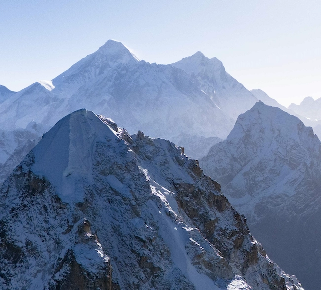
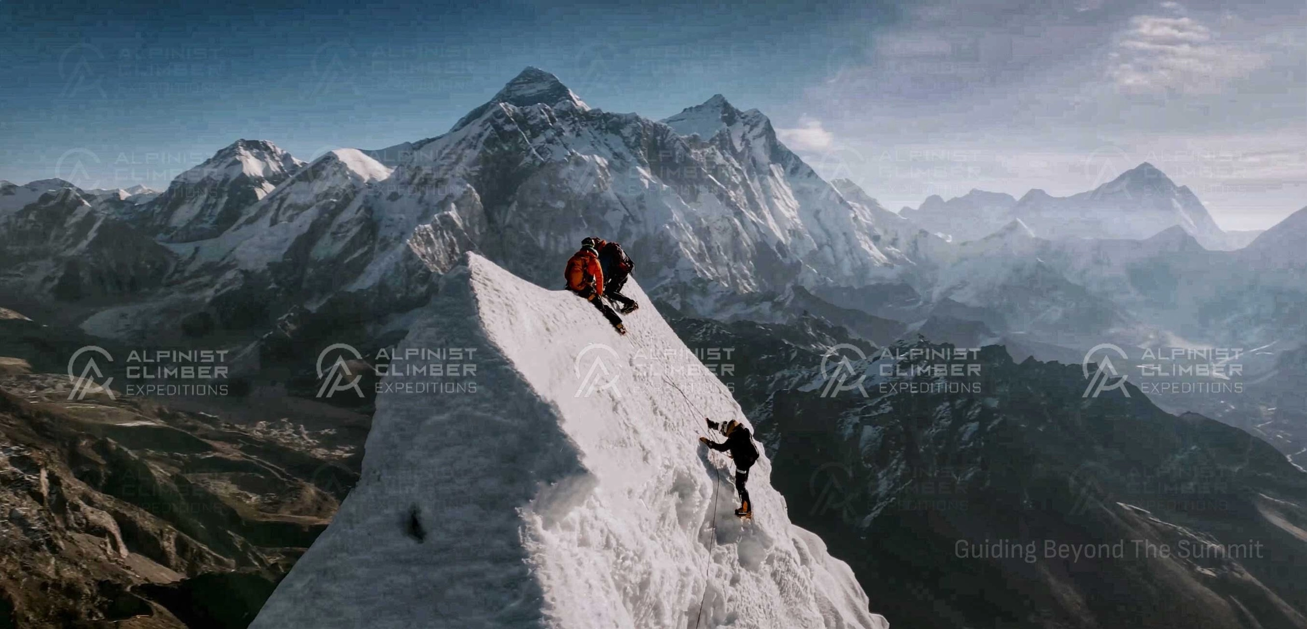
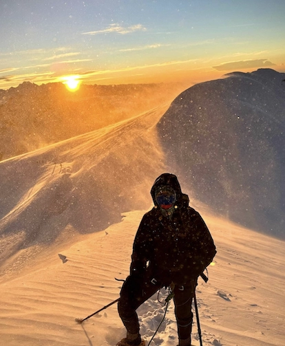
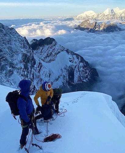
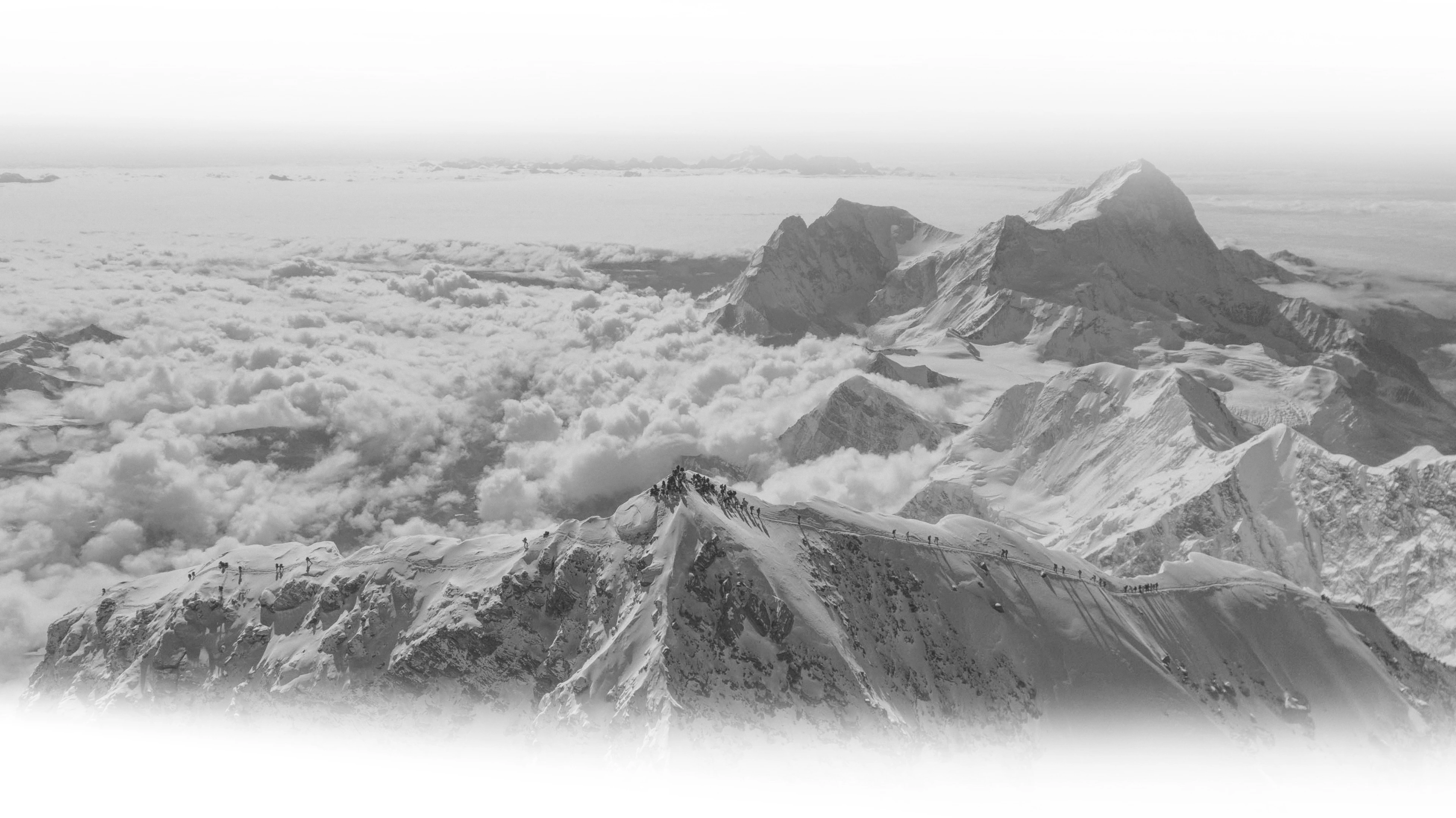
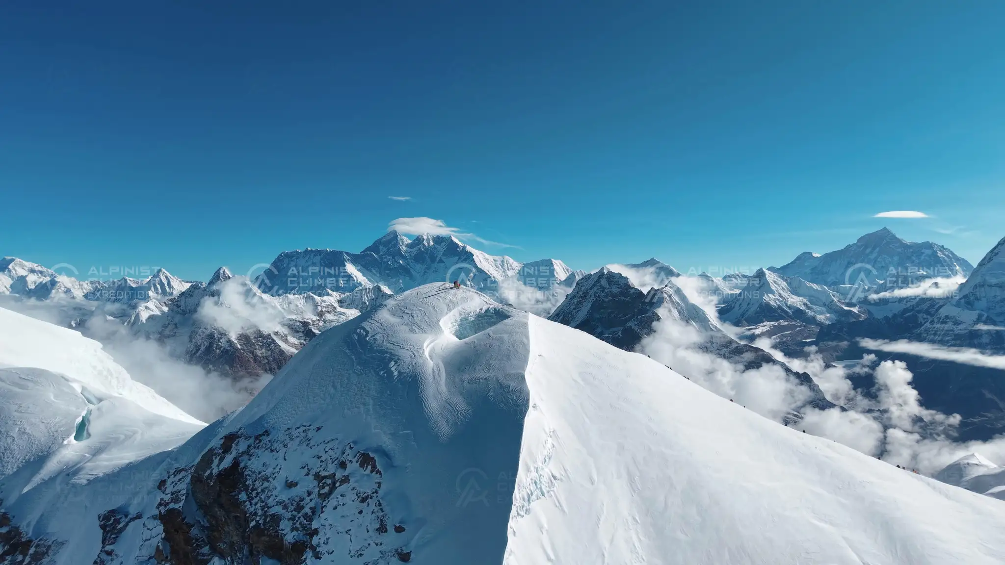
In November 2022, two teams from Alpinist Climber Expeditions climbed Mera Peak (6,476m) as part of a ski expedition. One team skied down from the summit using Base Camp only; the other followed the standard route via High Camp. Both teams reached the summit safely.

This report covers the trek in from Sotang, the acclimatization stops along the way, and the two different routes the teams took to the top.


Expedition Overview

•     Peak: Mera Peak (6,476m)

•     Region: Hinku Valley, Makalu Barun National Park, Solukhumbu District, Nepal

•     Summit date: 14 November 2022

•     Starting point: Kathmandu, with a 12-hour jeep drive to Sotang

•     Route: Sotang → a Sherpa village at 2,000m → high pass acclimatization (~4,500m) → Panch Pokhari → Kholakharka → Khote (3,600m) → Tangnag → Khare (4,900m) → Mera Peak summit, via two different routes

•     Guiding: Led by Alpinist Climber Expeditions' team, with an experienced, professional mountain guide

•     Style: Two teams — one completed a ski ascent and descent using Base Camp only; the other used the standard High Camp route

•     Outcome: Both teams reached the summit safely; the ski team continued on toward Baruntse Base Camp afterward


Full Expedition Report


Day 1: Kathmandu to Sotang

The trip began with a 12-hour jeep drive from Kathmandu to Sotang, starting at 4 a.m. The drive included stops in cultural villages along the way, with views of rural life away from the city.

Day 2: Sotang to a Sherpa Village (2,000m)

From Sotang, the team hiked four hours through a remote jungle trail used mainly by local people, to a Sherpa village at 2,000 metres, where they spent the night.

Day 3: Village Rest and On to the Next Village

The next day included a short tour of the village and a nearby monastery before the team continued toward the next village. The trail passed through rhododendron forest and past waterfalls coming down from the hillside.

Day 4: Acclimatization at the High Pass (4,500m)

As part of the acclimatization plan, the team hiked up to a high pass at around 4,500 metres and then slept lower, at 4,200 metres, a standard technique for adjusting to altitude.

Day 5: Panch Pokhari to Kholakharka

Past the high pass, the trail led through Panch Pokhari, five glacial lakes considered holy in the area. After a short break, the team continued to a lodge in a small valley called Kholakharka.

Day 6: Kholakharka to Khote (3,600m)

From Kholakharka, the route to Khote started with an hour-long ascent, followed by a steep descent through the jungle. Low cloud settled over the valley as the team walked down toward the Inkhu Khola river, which they crossed by bridge before reaching Khote in the afternoon. From Khote, the team had clear views of Mera Peak at night.

Days 7–8: Acclimatizing in Khote

The team spent two nights in Khote to acclimatize and rest before continuing higher.

Day 9: Khote to Tangnag

The walk from Khote to Tangnag followed the river through forest and moraine terrain, gaining about 700 metres in elevation on a gradual trail with no steep sections. The team arrived in Tangnag late in the morning, with more snow-covered peaks coming into view.

Day 10: Tangnag to Khare (4,900m)

After breakfast, the team continued to Khare, the last lodge before the higher camps and the final stop before the Mera Peak ascent. The afternoon was spent checking and preparing ski and climbing equipment for the days ahead.

Days 11–12: Acclimatizing in Khare

The team spent two days in Khare to acclimatize before moving higher.

The Ski Team: Base Camp to Summit

One team continued to Mera Peak Base Camp (5,300m), skipping High Camp: since the plan was a faster ski ascent and descent, Base Camp served as a better staging point. After further acclimatizing and preparing a summit plan at Base Camp, the team had dinner around 6 p.m. and went to sleep early to save energy. They woke at 1 a.m., had porridge and hot tea, and left Base Camp at around 2 a.m. for the summit.|

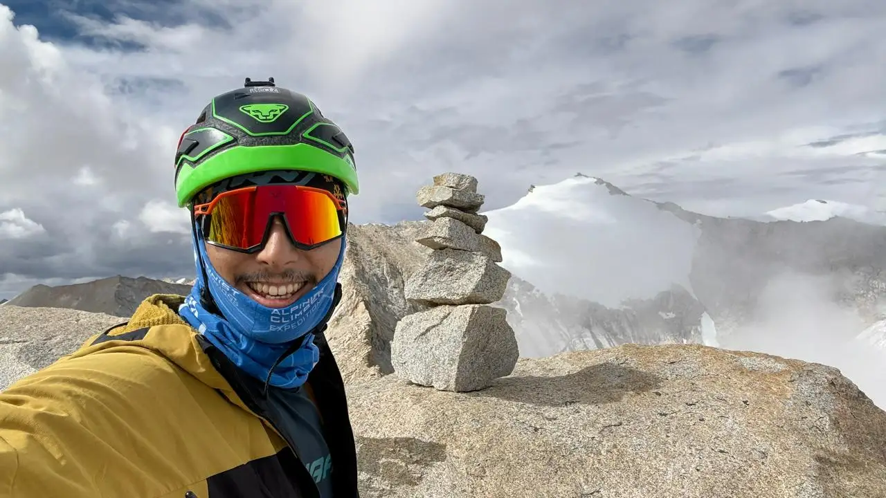
The climb involved a steady, sustained elevation gain. The team reached the summit of Mera Peak (6,476m) and, after enjoying the view, skied back down to Khare, arriving after a few hours. After resting, they continued on toward Baruntse Base Camp, the next stage of the trip.

The Second Team: High Camp to Summit

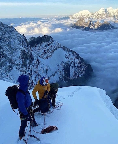
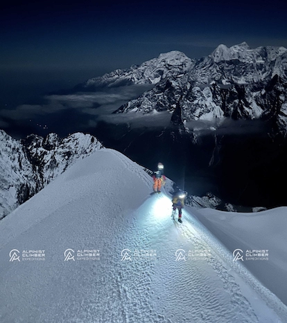
A second group left Khare a day later and followed the standard route, spending the night at High Camp (5,800m). Climbing at night, the team saw a bright meteor streak across the sky and managed to photograph it. After a few hours of climbing, the second team also reached the summit of Mera Peak.


Challenges

•     The 12-hour jeep drive from Kathmandu to Sotang to begin the trip

•     A long acclimatization sequence — a high pass at 4,500m, sleeping lower at 4,200m, and further rest stops at Khote and Khare — before the summit push

•     A steady, sustained elevation gain on the final push to the summit, particularly for the ski team's faster Base Camp-only ascent

•     Skiing a technical descent from 6,476m after a demanding summit push

•     Early, cold starts (1 a.m. wake-ups) for both teams' summit pushes


Highlights

•     Cultural stops in rural villages on the drive from Kathmandu to Sotang

•     A remote jungle trail to a Sherpa village at 2,000m

•     Rhododendron forest and waterfalls on the trail to the next village

•     Panch Pokhari's five holy lakes

•     Clear night views of Mera Peak from Khote

•     A ski descent from the 6,476m summit

•     A bright meteor spotted and photographed by the second team during their night climb

•     Both teams reaching the summit safely


Safety

The trip's acclimatization plan followed a staged approach: a high pass ascent followed by a lower sleeping altitude, two nights in Khote, and two more days in Khare before the summit push. The two teams also split into different routes suited to their plans — the ski team used Base Camp only for a faster ascent and descent, while the second team took the standard route via High Camp.

Both teams summited and returned safely, with the notes crediting an experienced, professional guide for keeping the climb safe throughout.


Conclusion

This Mera Peak expedition combined a standard guided route with a ski descent, run as two teams with different plans suited to their goals. Both teams reached the 6,476m summit safely, and the ski team's descent, along with the second team's meteor sighting from High Camp, made for two distinct accounts of the same mountain.

Mera Peak's mix of manageable technical difficulty and big-mountain views is why the notes describe it as suitable for both beginners and advanced climbers, provided the climb is guided by an experienced, professional mountain guide. Alpinist Climber Expeditions has been leading guided climbs, and ski expeditions, on Mera Peak since 2021.

Related Blogs

Chhuama IV First Ascent Report 2026
Expedition Journal

Chhuama IV First Ascent Report 2026

  In July 2026, a team from Alpinist Climber Expeditions climbed Chhuama IV, a 6,179-metre peak in the Mustang region of Nepal that no one had ever summited before. On 16 July, IFMGA Mountain Guide and Dynafit athlete Prakash Sherpa reached the top at 3:21 PM Nepal time, after teammate Barnaby Francis turned back roughly 250 metres from the summit because of dangerous rockfall. Six earlier permit teams had tried and failed to climb Chhuama IV. This was the seventh attempt, and it succeeded — making it the first recorded ascent of the mountain. This is the story of that expedition: how the team got to the mountain, what the route was actually like, and what happened during the final push to the summit.   About Alpinist Climber Expeditions Alpinist Climber Expeditions is a Nepal-based expedition company that has been running alpine-style expeditions in the Himalayan ranges of Nepal since 2021. The Chhuama IV climb fits the kind of objective the company tends to take on: a lesser-known peak, a small team, and a route that hadn't been fully worked out by anyone before them. Alpine-style climbing generally means moving with a small team and minimal fixed infrastructure on the mountain, relying on judgment and route-finding rather than large-scale siege tactics — and that approach mattered on Chhuama IV, where conditions changed quickly and decisions had to be made on the spot.   The Peak and Why This Expedition  Was Different Chhuama IV sits in the Mustang region of Nepal and stands 6,179 metres high. Before this expedition, six other permit teams had attempted the mountain. None of them reached the top. That history says something about the peak — this wasn't a case of nobody having tried. Climbers had gone up before, assessed the conditions, and turned back. Alpinist Climber Expeditions' team was the seventh group to hold a permit for Chhuama IV. Reaching the summit meant succeeding where six previous attempts hadn't, on a mountain with no established route and no prior summit to reference for conditions, timing, or line of ascent.   Preparing for the Expedition and the Approach  to Base Camp The trip began on 9 July 2026 with a drive from Kathmandu to Pokhara, followed the next day by the long drive from Pokhara to Jomsom. On 11 July, the team continued by road from Jomsom to Lo Manthang, the historic walled town in Upper Mustang. The team spent 12 July acclimatizing in Lo Manthang before moving on. On 13 July they drove from Lo Manthang to Nymdo, and on 14 July they trekked from Nymdo to Base Camp. The following day, 15 July, they moved up from Base Camp to Lower High Camp — the last stop before the summit attempt. This slower, staged approach — drive, acclimatize, drive again, then trek up in stages to Base Camp and Lower High Camp — gave the team time to adjust to altitude before the technical climbing began.   Climbing Conditions on Chhuama IV Once the team got onto the mountain itself, the terrain turned out to be the main obstacle. The route up Chhuama IV involved long stretches of loose, unstable rock, slopes that could shift underfoot, and frequent rockfall. In the upper sections, there were only limited safe options for where to actually put a route, which meant the team had to keep reassessing the terrain as they climbed rather than following a fixed line. Weather added another layer of difficulty. Conditions changed often during the expedition, and on the day chosen for the summit push, the team had only a short window of favourable weather to work with. That combination — unstable ground below and a narrow weather window above — shaped almost every decision made on summit day.   The Summit Push : 16 July 2026 The team began its summit push from Lower High Camp on 16 July 2026. From early on, the upper mountain was hazardous. Rockfall was continuous, and the loose terrain meant every section had to be evaluated as they went, not assumed safe because it had been climbed before. Barnaby Francis climbed with the team through this section but made the decision to turn back approximately 250 metres below the summit. The reason was straightforward: the rockfall and the state of the terrain above made continuing unsafe. It was a judgment call made in the moment, based on what was actually happening on the mountain rather than on how close the summit looked. From that point, IFMGA Mountain Guide Prakash Sherpa continued alone. He worked through the difficult, unstable upper section and kept going where the conditions had stopped his teammate. This wasn't a case of pushing through recklessly — it reflects the kind of terrain assessment that comes with IFMGA-level guiding experience, where the decision to continue or turn back is made section by section.   Reaching the Summit Prakash Sherpa reached the summit of Chhuama IV, at 6,179 metres, at 3:21 PM Nepal Local Time on 16 July 2026. With six previous permit teams having failed to summit the mountain, this made Alpinist Climber Expeditions' team the first to do so. The expedition is recorded by the team as the first recorded ascent of Chhuama IV — a first ascent of a Nepal peak that had resisted six prior attempts before this one succeeded. After the summit, the team descended back toward Lower High Camp on the same day.     The Team's Experience  and the Way Down The climbing team for this expedition was small: Barnaby Francis from the United Kingdom, IFMGA Mountain Guide Prakash Sherpa, and Ngima Tashi Sherpa as supporter. On a mountain with unstable rock and shifting weather, decisions had to be made quickly and by people who knew the terrain — which is part of why Barnaby Francis's decision to turn back, and Prakash Sherpa's decision to continue, both mattered as much as the summit itself. The descent and return followed a similarly staged plan to the approach. On 17 July, the team trekked roughly 2.5 hours down from Lower High Camp before driving on to Pokhara. On 18 July, they completed the trip with the drive from Pokhara back to Kathmandu.   What Made This First Ascent  Significant Chhuama IV wasn't an easy objective, and it wasn't an obscure line that simply hadn't attracted attention. Six permit teams before Alpinist Climber Expeditions had tried to climb it and hadn't succeeded, which points to real difficulty rather than a lack of interest. The loose rock, the rockfall, and the narrow weather windows on summit day were the actual obstacles that had stopped previous attempts — and they were still present for this expedition. What changed the outcome wasn't a shortcut around those conditions. Barnaby Francis's decision to turn back 250 metres from the top, made because the risk was too high, and Prakash Sherpa's decision to continue where conditions allowed it, together produced the first known summit of the mountain. Both decisions came from reading the same terrain and weather correctly.   Conclusion The Chhuama IV expedition, carried out by Alpinist Climber Expeditions in July 2026, resulted in the first recorded ascent of Chhuama IV 6,179-metre peak in Nepal's Mustang region — a mountain that had already turned back six permit teams before this one. On 16 July 2026, after Barnaby Francis turned back roughly 250 metres below the summit due to rockfall and unstable terrain, IFMGA Mountain Guide Prakash Sherpa continued and reached the top at 3:21 PM Nepal time. It wasn't a straightforward climb, and the notes from the expedition don't describe it as one. Loose rock, frequent rockfall, and a narrow weather window shaped nearly every part of the summit day. Given that history, reaching the summit of Chhuama IV for the first time is a meaningful outcome — one built on careful, terrain-by-terrain decision-making rather than a single dramatic push to the top.     #GuidingBeyondTheSummit  #Dynafit 
Aug 12, 2026 Read More →
Cholatse Expedition Report 2022
Expedition Journal

Cholatse Expedition Report 2022

  Two high camps, a 250m headwall, and a midnight departure into deep snow and crevasses — Cholatse doesn't give up its summit easily. This report picks up right after our team's successful climb of Kyajo Ri, as we turned toward one of the most technical 6,000m peaks in the Khumbu.   This is the story of our Cholatse expedition (6,440m): a trek through Gokyo and across the Ngozumpa Glacier to reach Dragnak, a two-camp summit push through crevasses and steep snow, and a hard-earned summit that made every bit of the effort worth it.   If you're researching Cholatse before booking your own Cholatse expedition package, this report also covers what most climbers ask us: how technical the route really is, what the two-camp system looks like, and what kind of experience you need before attempting it.   Expedition Overview •     Peak: Cholatse, 6,440 m (21,128 ft) •     Region: Khumbu Region, near Gokyo and Dragnak, Everest Region, Nepal •     Summit Date: 15 May 2022 •     Starting Point: Namche Bazaar, via Gokyo and Dragnak •     Route: Namche Bazaar → Gokyo → Dragnak (via the Ngozumpa Glacier) → Base Camp (4,700 m) → Camp 1 (5,600 m) → Camp 2 (5,850 m) → Summit •     Guiding: Led by an IFMGA-certified mountain guide from Alpinist Climber Expeditions, supported by our climbing Sherpa staff •     Weather: Warm and sunny during the base camp rest days, with a long, demanding summit night through deep snow   Cholatse is widely regarded as one of the most technical 6,000m peaks in the Khumbu, with sustained mixed rock, ice, and snow climbing that's often compared to Ama Dablam in difficulty. It's a serious step up from trekking peaks like Kyajo Ri or Lobuche East, which is exactly why our team climbed it directly after Kyajo Ri, using the acclimatization already built up to take on a harder, more committing objective.   Full Expedition Report   Recovery in Namche Bazaar After the successful summit of Kyajo Ri, we headed back to Namche Bazaar for two days to recover and get ready for Cholatse. It was a chance to rest properly before turning toward a much more technical objective.   Gokyo and the Climb to Gokyo Ri (5,357 m) From Namche, we ascended to Gokyo, where we spent two days. Gokyo sits beside a large glacial lake, ringed by 6,000m peaks in every direction. We climbed up to Gokyo Ri (5,357 m) for a panoramic view over the lake and the surrounding mountains which is one of the best viewpoints in the entire region.   Gokyo to Dragnak via the Ngozumpa Glacier Leaving Gokyo, we hiked to Dragnak, the last village before Cholatse base camp. Getting there means crossing a long glacier flowing down from Mount Cho Oyu — the Ngozumpa Glacier. Along the way we passed several glacier lakes in a striking light-blue color, and at the far end of the glacier, Cho Oyu filled the skyline. We reached Dragnak and spent the rest of the day on final preparations for the climb.   Dragnak to Cholatse Base Camp (4,700 m) The walk to base camp took about an hour and a half from Dragnak. Base camp sits at 4,700 m in a flat valley that yaks wander through during the day to graze on the fresh grass. Our staff welcomed us with hot tea and a good meal as soon as we arrived.   Rest at Base Camp We took two rest days at base camp, though we didn't need much extra acclimatization since we were already adjusted from the Kyajo Ri climb. The days were warm and sunny providing the team with good conditions to relax and prepare gear before the summit push.   Base Camp to Camp 1 (5,600 m) After two days of rest, we left base camp and the summit push began. Because the route to the top is long, we planned it around two camps. On the way to Camp 1 we crossed several crevasses before climbing a 250m headwall. Camp 1 turned out to be a comfortable spot, set on a ridge col.   Camp 1 to Camp 2 (5,850 m) The next day we reached Camp 2 — small, exposed, but with a beautiful view in every direction. We rested for a few hours before heading out at midnight for the summit.   Summit Day (15 May 2022) The route from Camp 2 was long, with deep snow and numerous crevasses to negotiate through the night. We reached the summit of Cholatse in the morning, and after taking in the views, descended back to Camp 2 to sleep as the summit day had been long and genuinely tiring.   Return to Base Camp The next day we made it back down to base camp, where we celebrated our Cholatse summit. It had been a hard climb, but the views along the way made us forget about the effort it took to get there.   Challenges •     Multiple crevasse crossings on the way to Camp 1, requiring careful rope work •     A 250m headwall between base camp and Camp 1 •     A small, exposed Camp 2 (5,850 m) with only a few hours of rest before the summit push •     A long midnight summit push through deep snow and numerous crevasses •     A genuinely tiring summit day, requiring a recovery stop at Camp 2 before continuing the descent •     Tackling one of the Khumbu's more technical 6,000m peaks directly after a separate expedition on Kyajo Ri   Highlights •     The panoramic view from Gokyo Ri (5,357 m) over Gokyo Lake and the surrounding 6,000m peaks •     Crossing the Ngozumpa Glacier, with light-blue glacier lakes and Cho Oyu filling the skyline •     Yaks grazing beside base camp during warm, sunny rest days •     A comfortable Camp 1 set on a scenic ridge col •     Reaching the summit of Cholatse after a long, technical night climb •     Celebrating the summit back at base camp with the whole team   Safety Cholatse is not a peak that allows for shortcuts. Multiple crevasse crossings, a 250m headwall, and a long summit night through deep snow all demand careful, deliberate decision-making.   Having already acclimatized on Kyajo Ri gave the team a real advantage heading into Cholatse, reducing the extra rest needed at base camp and letting us focus on the technical demands of the route itself. Splitting the summit push across two camps (5,600 m and 5,850 m) kept the climb manageable, and resting at Camp 2 on the way down after a long summit day was an important call rather than pushing straight through to base camp.   As with every expedition we run, our IFMGA-certified guide and Sherpa climbing staff led the technical sections: the crevasse crossings, the headwall, and the roped travel through deep snow on summit night with safety as the deciding factor at every stage.   Conclusion Climbing Cholatse directly after Kyajo Ri pushed the team in a different way as this wasn't a technical trekking peak, but one of the more serious technical objectives in the Khumbu, with a long two-camp summit push through crevasses and deep snow. It was a hard climb from start to finish.   But the views from Gokyo Ri, across the Ngozumpa Glacier, and finally from the summit itself made the effort worth it. We're grateful for a safe climb, a strong team, and a mountain that earned every bit of our respect.   If a serious technical objective like Cholatse is on your list, we'd be glad to help you plan a safe, well-guided climb with Alpinist Climber Expeditions — explore our upcoming expeditions to see what's next.  

May 15, 2022 Read More →
Lobuche East Expedition Report 2022
Expedition Journal

Lobuche East Expedition Report 2022

  This is the story of one of our Lobuche East expeditions, climbed in the Khumbu region of Nepal under clear spring skies. Our team crossed Cho La Pass, rested and acclimatized in Lobuche village, pushed up to high camp, and stood on the summit of Lobuche East as the sun came up over Everest, Lhotse, and Nuptse. It's a climb that rewards patience, fitness, and good decision-making and this report walks through exactly how it unfolded. If you're researching Lobuche East before booking your Lobuche East expedition, this report also answers the questions most climbers ask us: how hard is it, how long does it take, and what does the summit push actually feel like.   Expedition Overview  •     Peak: Lobuche East, 6,119 m (20,075 ft) •     Region: Khumbu Region, Everest Region, Nepal •     Summit Date: 21 May 2022 •     Starting Point: Dragnak, via Cho La Pass (5,420 m) •     Route: Standard Lobuche East route — Lobuche village to High Camp (5,270 m), then the summit ridge via the crampon point •     Guiding: Led by an IFMGA-certified mountain guide from Alpinist Climber Expeditions, supported by our climbing Sherpa staff •     Weather: Clear, cold, and stable throughout, with a fully clear night sky on summit day   Lobuche East sits close to the classic Everest Base Camp trekking trail, which is part of what makes it such a popular introduction to Himalayan peak climbing as you get glacier travel, a real alpine summit push, and some of the best mountain views in the Khumbu, all within a route that's shorter and less committing than an Everest-scale expedition.   Full Expedition Report   Dragnak to Lobuche Village via Cho La Pass We left Dragnak early in the morning to cross Cho La Pass (5,420 m). The trail up to the pass is one of the most scenic stretches in the entire Khumbu with big mountains on every side, and Mount Cho Oyu standing out clearly in the distance. We reached Dzongla earlier than expected, and with good energy in the team and daylight still on our side, we made the call to keep moving to Lobuche village rather than stopping early. The trail from Dzongla to Lobuche is quiet compared to the main Everest Base Camp corridor, and we had the path almost to ourselves giving us a rare kind of stillness in a region that's usually busy with trekkers. Arriving in Lobuche village, we got our first real look at Nuptse (7,861 m), rising directly across the valley. It's a mountain that draws the eye immediately — steep, dramatic, and climbed by only a small number of mountaineers over the years.   Rest and Acclimatization in Lobuche We spent two full days resting in Lobuche before heading up to high camp. These weren't idle days as this is when the real preparation happens. We sorted gear, checked equipment one more time, and let our bodies adjust to the altitude. There's a particular kind of anticipation that builds during rest days like these, everyone quietly aware that the technical part of the climb is now close.   Lobuche to High Camp (5,270 m) The move up to high camp is short on paper but tough in practice. The trail follows a valley before turning into a steep, rocky, short climb right at the end. High camp itself sits in a rocky area above a small lake, which we used as our water source. We had dinner at camp and were in our tents by around 7 p.m. — an early night, but a necessary one, with a 1 a.m. wake-up call ahead of us.   Summit Day (21 May 2022) We were up at 1 a.m. Breakfast was simple as we had porridge and plenty of tea and by 2 a.m. we were moving. Everything outside the tent had frozen overnight, and the early sections of the route were rocky and largely free of snow, which made our journey technical before we'd even reached the crampon point. Past the crampon point, the climbing changed character completely: sustained 45-degree slopes that demand real stamina and upper-body strength to move through efficiently. The night was clear the entire time, and as we climbed we could pick out Everest, Lhotse, Nuptse, Pumori, Makalu, Cholatse, and Ama Dablam standing sharp against the sky. At 6:02 a.m., we stood on the summit of Lobuche East. It's a small summit so there wasn't room for a large group up there and on this particular morning, we were the only team on the mountain. Standing on top with clear views in every direction, entirely alone, is not something every expedition gets to experience. After a safe summit, we began the descent back to high camp to rest, well aware that reaching the top is only half the job as we always have to think about a safe descent as well.   Challenges •     Rocky, snow-free terrain below the crampon point — technical and slow-going before the real climbing even started •     Sustained 45-degree slopes above the crampon point, demanding stamina and physical strength rather than pure technique •     Overnight freezing conditions, which affected gear, pace, and comfort during the alpine start •     Short acclimatization window between Lobuche village and the summit push, managed carefully through the two rest days •     Ongoing decision-making about pacing and timing, since a strong summit push means nothing without a controlled descent   Highlights •     A perfectly clear summit night with views of Everest, Lhotse, Nuptse, Pumori, Makalu, Cholatse, and Ama Dablam •     Reaching the summit of Lobuche East completely alone as a team, with no one else on the mountain that morning •     The 6:02 a.m. summit moment itself, arriving just as the light came up •     The first view of Nuptse from Lobuche village •     Cho Oyu dominating the skyline from Cho La Pass •     The quiet, uncrowded trail between Dzongla and Lobuche village   Safety Safety on Lobuche East comes down to a few things done consistently well: proper acclimatization, sound route decisions, and a team that communicates clearly under pressure. On this climb, that meant building in two rest days in Lobuche before pushing to high camp, reading the rocky, snow-free terrain carefully before the crampon point, and pacing the 45-degree summit slopes so the team still had strength in reserve for the descent. Reaching a summit is only ever half the climb as getting back down safely is what actually defines a successful expedition. This is the same safety-first approach that runs through every expedition we run at Alpinist Climber Expeditions: IFMGA-certified guides, experienced Sherpa climbing staff, and decisions that always prioritize the team's safety over summit ambition.   Conclusion Standing on the summit of Lobuche East at 6:02 a.m., alone on the mountain with Everest, Lhotse, and Ama Dablam laid out in every direction, is the kind of moment that reminds you why this region draws climbers back again and again. It wasn't an easy climb with the rocky sections before the crampon point and the sustained slopes above it, but it was a controlled one. The biggest lesson from this expedition is one worth repeating: safety and success aren't competing priorities. Done right, they're the same thing. We're grateful to the mountain, to the route, and to the team that made the climb what it was. If Lobuche East is on your own list, we'd be glad to help you plan a safe, well-guided climb with Alpinist Climber Expeditions — explore our upcoming Lobuche East expeditions to see what's next.  

May 21, 2022 Read More →
Client Stories

From the Summit

Daniel Puttkemery
Daniel Puttkemery
Kyajo Ri Expedition
5/5 Rating

Prakash and his team are a couple of notches above totally professional! Everyone in the Alpinist Climber Expeditions family goes out of their way to provide the best possible experience. Superb core values and safety principles. I had the good fortune of climbing Kyajo Ri with Alpinist Climber Expeditions and I can not say enough positive things. All gear is first rate, exceptional food and beautiful base camp in particular. I have climbed with a few different outfits in the past, now I need look no further, whenever I’m in the Himalaya. I will only climb with Alpinist Climber Expeditions. It sounds cliche but they very much made me feel like family. Top marks to a top outfit!

Verified Client Story
Luca Smargiasso
Luca Smargiasso
Ama Dablam 6,812m
5/5 Rating

I have been climbing for 15 years, over 4 continents. This was my 3rd trip to Nepal. And this was undoubtedly one of the Best-organised expeditions have participated in. Cannot thank Prakash and his Team enough. The attention to detail both in terms of equipment, climbing conditions, and accommodation/food was outstanding. And despite having limited exposure to high altitude alpine style climbing, always felt comfortable in the climbs and approach. I put this down to Prakash and his experience as well as the unique approach to team size. The small team ensures that a more flexible and sensible approach is applied to all technical aspects of the climb-including importantly how you physically feel and acclimatise. I needed to spend 5 days at Namche due to a sinus infection, and never felt that this jeopardised the rest of my climb. The same goes for weather delays. I eventually overran the climbing calendar by 5 days without a single complaint from Prakash and his team. You feel like a climbing partner rather than a paying client. My only regret is that Alpinist Climber Expeditions does not have a more international footprint as would have liked to climb with Prakash and his Team internationally as well as in Nepal.

Verified Client Story
Andy Tronsberg
Andy Tronsberg
Kyajo Ri & Island Peak
5/5 Rating
“Perfect organised and guided expedition I ever took part! We climbed island peak and kyajo ri alpine style! Safety is always first, all team members are super kind and professional and also laughing comes not to short! Thanks for this unforgettable experience!! Andreas.

Verified Client Story
Rogier Keulen
Rogier Keulen
Mt. Kyajo Ri & Mt. Cholatse
5/5 Rating
“With IFMGA guide Prakash we climbed Kyajo Ri and Cholatse. Our expedition couldn't have been any better! We had a lot of fun and summiting stunning Cholatse is the most intense thing I've done. We did it alpine style, so without fixed ropes from bottom to top. Safety was a priority - Prakash summited Everest 3 times and is always in control - and we had a very strong drive to reach the summit - which we did!”
Verified Client Story
Ludwig Beer
Ludwig Beer
Baruntse 7,162m + Mera Peak 6,476m
5/5 Rating
“Vielen Dank lieber Pemba für die tolle Zeit. Deine Professionalität und stete Fürsorge waren allgegenwärtig. Die gute Planung, der Ablauf und die gute Stimmung waren großartig. Mit Dir und Deinem Team fühlt man sich wohl am Berg. Dadurch ist der Erfolg gesichert!”
Verified Client Story
Christiaan Jong
Christiaan Jong
Mt. Kyajo Ri & Mt. Cholatse
5/5 Rating
“The Kyajo Ri and Cholatse climbing expedition I did with Alpinist Climber Expeditions was great! Our guide Prakash is a very strong and professional guide.
We share our values regarding alpine-style climbing and succeeded on both summits in a very safe manner.
Apart from the climbing, the whole team was super supportive, helpful, and friendly. Nothing was too much to ask.
For future expeditions or other endeavors in the mountains, I would definitely reach out to Alpinist Climber Expeditions again.”
Verified Client Story
Expedition Journal

Dispatches from the Mountains

All Articles
Chhuama IV First Ascent Report 2026
Expedition Report

Chhuama IV First Ascent Report 2026

  In July 2026, a team from Alpinist Climber Expeditions climbed Chhuama IV, a 6,179-metre peak in the Mustang region of Nepal that no one had ever summited before. On 16 July, IFMGA Mountain Guide and Dynafit athlete Prakash Sherpa reached the top at 3:21 PM Nepal time, after teammate Barnaby Francis turned back roughly 250 metres from the summit because of dangerous rockfall. Six earlier permit teams had tried and failed to climb Chhuama IV. This was the seventh attempt, and it succeeded — making it the first recorded ascent of the mountain. This is the story of that expedition: how the team got to the mountain, what the route was actually like, and what happened during the final push to the summit.   About Alpinist Climber Expeditions Alpinist Climber Expeditions is a Nepal-based expedition company that has been running alpine-style expeditions in the Himalayan ranges of Nepal since 2021. The Chhuama IV climb fits the kind of objective the company tends to take on: a lesser-known peak, a small team, and a route that hadn't been fully worked out by anyone before them. Alpine-style climbing generally means moving with a small team and minimal fixed infrastructure on the mountain, relying on judgment and route-finding rather than large-scale siege tactics — and that approach mattered on Chhuama IV, where conditions changed quickly and decisions had to be made on the spot.   The Peak and Why This Expedition  Was Different Chhuama IV sits in the Mustang region of Nepal and stands 6,179 metres high. Before this expedition, six other permit teams had attempted the mountain. None of them reached the top. That history says something about the peak — this wasn't a case of nobody having tried. Climbers had gone up before, assessed the conditions, and turned back. Alpinist Climber Expeditions' team was the seventh group to hold a permit for Chhuama IV. Reaching the summit meant succeeding where six previous attempts hadn't, on a mountain with no established route and no prior summit to reference for conditions, timing, or line of ascent.   Preparing for the Expedition and the Approach  to Base Camp The trip began on 9 July 2026 with a drive from Kathmandu to Pokhara, followed the next day by the long drive from Pokhara to Jomsom. On 11 July, the team continued by road from Jomsom to Lo Manthang, the historic walled town in Upper Mustang. The team spent 12 July acclimatizing in Lo Manthang before moving on. On 13 July they drove from Lo Manthang to Nymdo, and on 14 July they trekked from Nymdo to Base Camp. The following day, 15 July, they moved up from Base Camp to Lower High Camp — the last stop before the summit attempt. This slower, staged approach — drive, acclimatize, drive again, then trek up in stages to Base Camp and Lower High Camp — gave the team time to adjust to altitude before the technical climbing began.   Climbing Conditions on Chhuama IV Once the team got onto the mountain itself, the terrain turned out to be the main obstacle. The route up Chhuama IV involved long stretches of loose, unstable rock, slopes that could shift underfoot, and frequent rockfall. In the upper sections, there were only limited safe options for where to actually put a route, which meant the team had to keep reassessing the terrain as they climbed rather than following a fixed line. Weather added another layer of difficulty. Conditions changed often during the expedition, and on the day chosen for the summit push, the team had only a short window of favourable weather to work with. That combination — unstable ground below and a narrow weather window above — shaped almost every decision made on summit day.   The Summit Push : 16 July 2026 The team began its summit push from Lower High Camp on 16 July 2026. From early on, the upper mountain was hazardous. Rockfall was continuous, and the loose terrain meant every section had to be evaluated as they went, not assumed safe because it had been climbed before. Barnaby Francis climbed with the team through this section but made the decision to turn back approximately 250 metres below the summit. The reason was straightforward: the rockfall and the state of the terrain above made continuing unsafe. It was a judgment call made in the moment, based on what was actually happening on the mountain rather than on how close the summit looked. From that point, IFMGA Mountain Guide Prakash Sherpa continued alone. He worked through the difficult, unstable upper section and kept going where the conditions had stopped his teammate. This wasn't a case of pushing through recklessly — it reflects the kind of terrain assessment that comes with IFMGA-level guiding experience, where the decision to continue or turn back is made section by section.   Reaching the Summit Prakash Sherpa reached the summit of Chhuama IV, at 6,179 metres, at 3:21 PM Nepal Local Time on 16 July 2026. With six previous permit teams having failed to summit the mountain, this made Alpinist Climber Expeditions' team the first to do so. The expedition is recorded by the team as the first recorded ascent of Chhuama IV — a first ascent of a Nepal peak that had resisted six prior attempts before this one succeeded. After the summit, the team descended back toward Lower High Camp on the same day.     The Team's Experience  and the Way Down The climbing team for this expedition was small: Barnaby Francis from the United Kingdom, IFMGA Mountain Guide Prakash Sherpa, and Ngima Tashi Sherpa as supporter. On a mountain with unstable rock and shifting weather, decisions had to be made quickly and by people who knew the terrain — which is part of why Barnaby Francis's decision to turn back, and Prakash Sherpa's decision to continue, both mattered as much as the summit itself. The descent and return followed a similarly staged plan to the approach. On 17 July, the team trekked roughly 2.5 hours down from Lower High Camp before driving on to Pokhara. On 18 July, they completed the trip with the drive from Pokhara back to Kathmandu.   What Made This First Ascent  Significant Chhuama IV wasn't an easy objective, and it wasn't an obscure line that simply hadn't attracted attention. Six permit teams before Alpinist Climber Expeditions had tried to climb it and hadn't succeeded, which points to real difficulty rather than a lack of interest. The loose rock, the rockfall, and the narrow weather windows on summit day were the actual obstacles that had stopped previous attempts — and they were still present for this expedition. What changed the outcome wasn't a shortcut around those conditions. Barnaby Francis's decision to turn back 250 metres from the top, made because the risk was too high, and Prakash Sherpa's decision to continue where conditions allowed it, together produced the first known summit of the mountain. Both decisions came from reading the same terrain and weather correctly.   Conclusion The Chhuama IV expedition, carried out by Alpinist Climber Expeditions in July 2026, resulted in the first recorded ascent of Chhuama IV 6,179-metre peak in Nepal's Mustang region — a mountain that had already turned back six permit teams before this one. On 16 July 2026, after Barnaby Francis turned back roughly 250 metres below the summit due to rockfall and unstable terrain, IFMGA Mountain Guide Prakash Sherpa continued and reached the top at 3:21 PM Nepal time. It wasn't a straightforward climb, and the notes from the expedition don't describe it as one. Loose rock, frequent rockfall, and a narrow weather window shaped nearly every part of the summit day. Given that history, reaching the summit of Chhuama IV for the first time is a meaningful outcome — one built on careful, terrain-by-terrain decision-making rather than a single dramatic push to the top.     #GuidingBeyondTheSummit  #Dynafit 
Aug 12, 2026 Read Article →
Stay Connected